Part of the thrill for me in working on the Exploring Minnesota’s Natural History grant project is traveling to all sorts of new places around the state with each new image from the collections that come across my desk. As part of the metadata creation for our thousands of images of the flora and fauna of Minnesota, we are adding geographic coordinates – when locations are given – so that researchers will be able to identify the approximate place or point where a particular bird nested or a plant specimen was picked.
That brings me to the point of this post – Minnesota Point to be exact. The following images of a Piping Plover were taken from the glass plate negatives in the Bell Museum records. On the envelope that encloses each negative was written, “Minnesota Point, Duluth 5/24/38.” Now I’m aware of Park Point, which is a neighborhood of Duluth, but I had never heard of “Minnesota Point” as a place name before. Thankfully, I have some trusty resources at hand that can point me in the right direction to find the location where this Piping Plover was nesting in 1938.
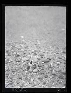
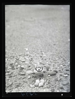
– Piping plover at nest, front view, Minnesota Point, St. Louis County, May 24, 1938
Minnesota Place Names, a geographical encyclopedia written by Warren Upham and published by the Minnesota Historical Society, has a fully searchable online counterpart. A search for Minnesota Point provided an entry for Park Point in St. Louis County. Park Point and Minnesota Point are essentially one in the same geographically, Minnesota Point being defined as “a very prolonged and somewhat broad sandbar beach reaching from the north shore near the center of Duluth about seven miles southeastward, which, with the similar but shorter Wisconsin Point, encloses the Duluth and Superior harbor, also known as the Bay of Superior.” The neighborhood of Park Point, formerly a village that was later annexed by Duluth, resides on Minnesota Point “south of and below the Duluth ship canal.”
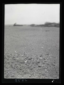 The Geographic Names Information System (GNIS), which was developed by the U.S. Geological Survey and the U.S. Board on Geographic Names, is the accepted Federal standard for all geographic nomenclature. The database contains records of all recognized historical and current geographical features in the United States. There are 65 different features, or categories of geological locations, from “Airport” to “Woods.” The GNIS record for Minnesota Point categorizes the location as a “Cape,” the definition of which is, “Projection of land extending into a body of water (lea, neck, peninsula, point).” The record locates the cape in St. Louis County, Minnesota, and gives two sequences of coordinates, the first of which (46.7282731 Latitude; -92.0479678 Longitude) I take and add to the records that describe the Piping Plover images.
Despite now knowing the location where this Piping Plover nested in 1938, it remains anybody’s guess as to what the Plover was looking around for…
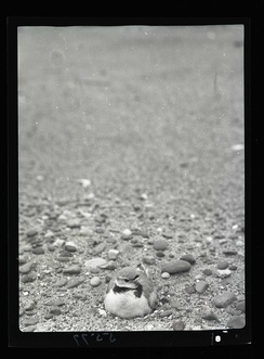
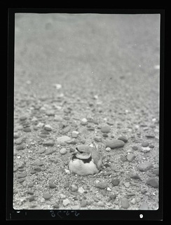
– Piping Plover on nest, front view, Minnesota Point, May 24, 1938.