Last summer I made a resolution to explore Minnesota by visiting destinations in my home state that I have not yet experienced. I started with an excursion to Ely and the Sudan mine last August, and just this past month, I finally visited the headwaters of the Mississippi River in Itasca State Park. In addition to my personal explorations, little did I anticipate that by working on this grant project I would have the opportunity to explore Minnesota in an entirely different manner – through the lenses of photographers C.J. Hibbard and Thomas Sadler Roberts.
When the Exploring Minnesota’s Natural History grant project launched in mid-April, dedicated student workers in Digital Library Services commenced scanning with two collections: the 2,000 + botanical specimen photographs of the Department of Botany, followed by the collection of 5,000 + glass plate negatives from the Bell Museum of Natural History. Both collections contain images of the flora, fauna, and geological features of the state taken as early as 1899.
After the images are scanned, it is my job to author the metadata and assign context to the images so that they can be easily searched and identified. This process includes transcribing often unintelligible handwriting, consulting multiple scientific databases to determine accurate names of flora, and regularly referring to Warren Upham’s Minnesota Place Names, to establish a sense of where all of these images were taken.
Fortunately, Hibbard, the photographer that produced the majority of the botanical specimen images, and Roberts, the physician and ornithologist with an interest in photography, kept meticulous records which have been well preserved at the University Archives. Through digitization, their images will hopefully inspire others to explore Minnesota as well.
After retiring from formal medical practice to pursue his avocation of ornithology, Thomas Sadler Roberts became Associate Curator of the Zoological Museum under the Department of Animal Biology at the University of Minnesota in 1915. Upon his appointment (initially unpaid), the University received a large gift – over 2,000 glass plate negatives from Roberts’s personal collection that he produced on various bird collecting and observation trips over the course of several decades. Roberts continued to produce glass plate negatives during his tenure at the museum, which not only document his bird studies, but also his research for constructing mounted habitat groups for display, as well as activities of the zoological museum as he developed it into an established Museum of Natural History (today known as the Bell Museum of Natural History).
While viewing and describing the first thousand or so images that have been scanned so far, I have electronically explored Lake Minnetonka, Heron Lake in Jackson County, King Lake in Meeker County, Lake Itasca, and Crooked Creek in Reno.
This week, while entering metadata to describe the scanned images of Hibbard’s botanical photographs, I traveled through more of the state – and the country. The first destination was Grand Marais:
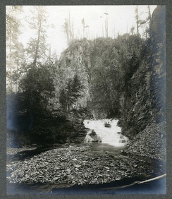
L. First cascade, Devils Track, near Grand Marais, Cook County, July 1900.
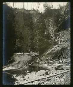
R. Devils Track gorge, near Grand Marais, Cook County, July 1900.
L: First Cascade, Devils Track, near Grand Marais, Cook County, July 1900.
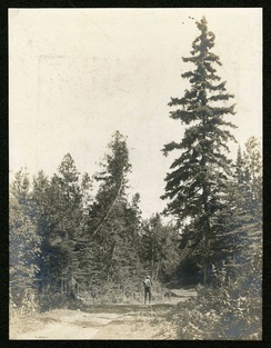
R: Gunflint Trail, July 1900.
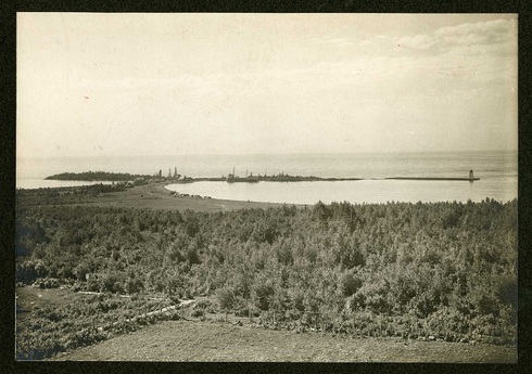
– Grand Marais from court house, Cook County, July 1900
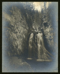
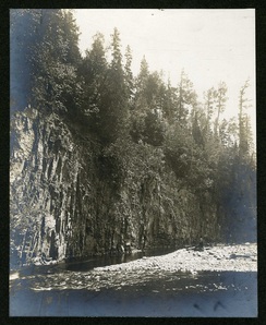
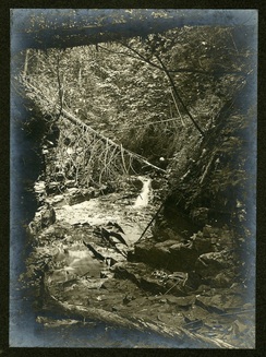
L: Upper Cascade, Devils Track, near Grand Marais, Cook County, July 1900.
R: Devils Track falls, near Grand Marais, Cook County, July 1900.
While northern Minnesota is ample with awe-inspiring natural vistas, southeastern MN has a fair share of geological formations and unique flora too. A series of photographs captioned with the location of “Winnebago Valley” highlight the beauty of this region in Houston County:
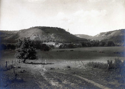
L: Winnebago Valley, Houston County, May, 1901
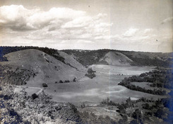
R: Winnebago Valley, no. 1 of a series of S.E. views, Houston County, May, 1901
L: Winnebago Valley, no. 2 of a series of S.E. views, Houston County, May, 1901
R: Winnebago Valley, no. 4 of a series of S.E. views, May, 1901
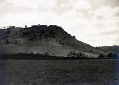
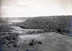
L: Castle Bluff, Winnebago Valley, Houston County, May, 1901
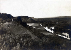
R: Mississippi River Valley, looking north from bluff above Jefferson, May, 1901
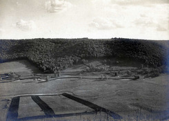
According to Upham’s Minnesota Place Names, “Winnebago Valley” was once a village in Winnebago Township in Houston County, with 2 mills, a hotel, stores, and a post office. It was a major through-point that welcomed the influx of Eastern settlers to Minnesota during the second half of the 19th century.
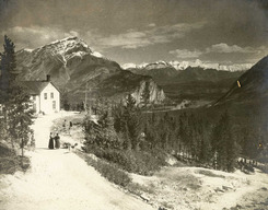
The Winnebago Valley images begin in box 23 and extend into box 24, where I encountered a drastic change in location and plant subjects: Canada and algae. Following the fieldwork and photography in Winnebago Valley in 1901, Hibbard and U of M scientists traveled through Banff, Canada en route to the Minnesota Seaside Station established at Port Renfrew in British Columbia. Here are a few images from the trip:
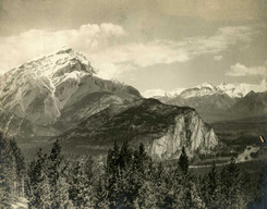
L: Cascade Mountain, Banff, Alberta, Canada, June 1901
R: Cascade Mountain, Banff, Alberta, Canada, June 1901
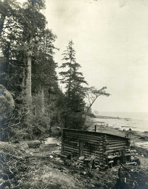
– Minnesota Seaside Station laboratory, June, 1901
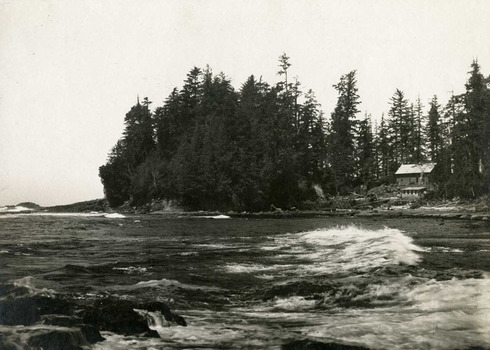
– Camp from Baird’s Point, Minnesota Seaside Station, Port Renfrew, British Columbia, June 1901
If these images entice you, don’t worry, there are more! As I have uncovered, the tale of the Minnesota Seaside Station deserves further elaboration in its own blog post – or two. And thanks to C.J. Hibbard, there is ample visual documentation to tell the story.
Stay tuned for continued explorations throughout Minnesota and beyond…